Hiking a Slot Canyon with Friends

Last week, I took the best hike ever! First off, the hike involved a slot canyon, and second, the experience was shared with friends. Yes sirree, it was an awesome morning filled with amazing scenery and lots of laughter.

Up until we started RVing full-time five years ago, I had never heard of a slot canyon. I had no clue what folks were talking about, but by reading blogs, I was introduced to Antelope Canyon. The photographs intrigued me to the point that I had to see and experience this magical sight for myself.

What is a slot canyon?

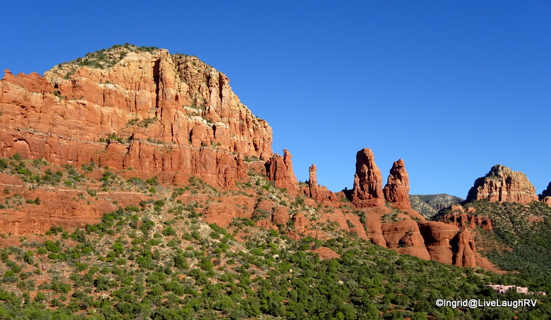
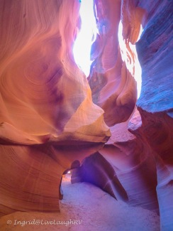
The first time I heard the term slot canyon, I remember asking myself, “What is a slot canyon?” I was totally clueless. So what exactly is it? A slot canyon is a narrow canyon formed by rock wearing away by water rushing through it. The split rock crevasses are polished by water and time and are a photographer’s delight. A slot canyon is much deeper than it is wide and many slots are formed in sandstone and limestone rock …. the perfect conditions here in northern Arizona and southern Utah.

Water Holes Canyon slot

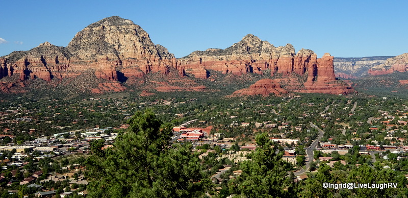
The most popular and world-renowned slot canyon in the United States is Antelope Canyon which is located in northern Arizona near the town of Page. Folks come from around the world to see this unique and stunning red rock slot.

Since Antelope Canyon is located on Navajo Indian land, the only way to experience these canyons is via a paid tour. Tours are usually not my thing, but ever since I hiked my first slot canyon at Kasha-Katuwe, I was eager to hike one of these red rock wonders. I pondered the thought of a tour …. but then ….

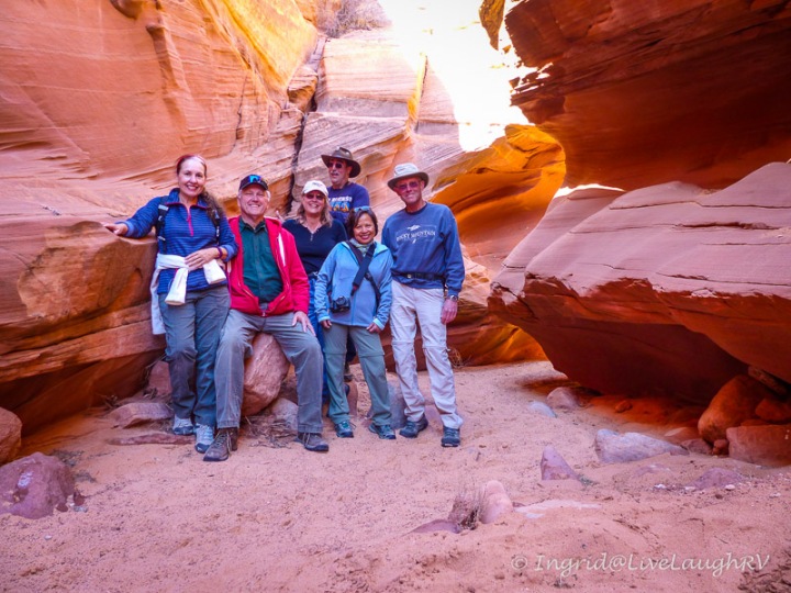
Friends plan a hike together

Mona Liza on the left, Faye in the middle and me on the right

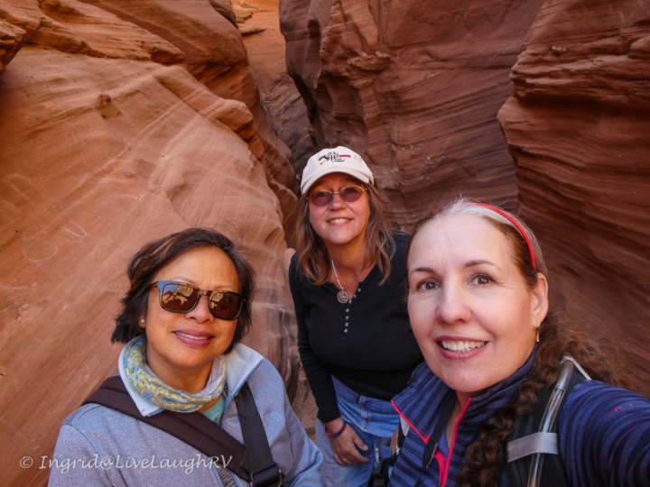
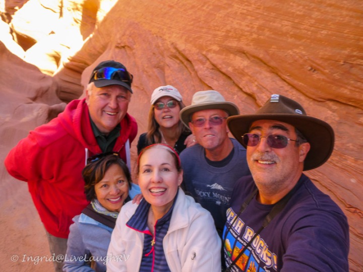
So let me set the stage for you ….. A couple of months ago, these three RV blogging pals began discussions on a potential rendezvous.  You see, Mona Liza and I met online via our blogs over five years ago. A couple of years later, I introduced Mona Liza to Faye, another friend I met via blogging.

friends made via bloggingOver the past few years, the three of us have crossed paths rather happenstance. I’ve bumped into these ladies separately in Texas, Arizona, Colorado, and even Idaho.

The three of us have serendipitously found ourselves camped in Texas and Arizona while Faye and Mona Liza have stumbled upon each other in Utah and Canada.

This past winter, Faye and I spent a month camped at the same RV park in Phoenix, Arizona, but it had been quite a while since either one of us had seen Mona Liza. Thus, a little planning was in order. Since Mona Liza and Steve had a well-planned RV travel itinerary scheduled with firm reservations, Faye and I did a little rearranging of our own schedules so the three of us could meet up.

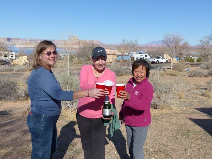
After comparing notes, it was decided Page, Arizona, would be the best place for us to connect even though we’d have less than 48 hours to hang out together. With that said, we didn’t waste any time. During our first happy hour, we discussed potential hikes for the following day.

We all love hiking slot canyons and our first consideration was the Wire Pass Trail, but that would require at least an hour’s drive north into Utah and the group didn’t want to waste our short time together driving. Plus, Mona Liza and Steve would be heading out of town and traveling the next day anyway.

hiking near Page, Arizona
Our group – me center front, Mona Liza on the left, my husband Al in the red, then Faye, Steve, and Dave

Unanimous decision

After a short discussion over drinks, we agreed on Water Holes Canyon for the hike of the day. Since this self-guided slot canyon trail is located on Navajo land, a permit is required. Obtaining the permits turned into a little laughable fiasco since much of the info we found online seemed to be outdated.

As of this writing, we purchased the permits to hike Waterholes Canyon at the  Lake Powell Navajo Tribal Park Office located on Coppermine Road, 3 miles south of Page and next to the LeChee Chapter House. We paid $12 per person and the office is closed on weekends.

Note: The state of Arizona does not participate in daylight savings time. We never change our clocks. BUT the Navajo Nation does. Depending on the time of year you visit, you’ll want to verify the time so you arrive at the appropriate hour for any Navajo Nation tour.  UPDATE – As of May 2018 access to the Waterholes Canyon trail is limited. Permits are no longer being issued and a guide is required. The information regarding this trail is ever-changing and confusing. Please do your homework for the latest information before embarking on any hike on Navajo land.

the trail from the parking lot to the canyon

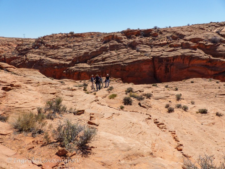
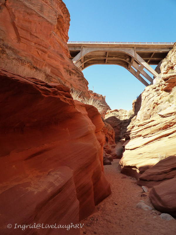
With permits in hand, we hit the trail around 9:00 a.m. (Arizona time). The trail is clearly marked with rocks leading from the tiny parking area down into the canyon. Once we navigated the steep descent into the canyon, we took a left heading east.

The trail also goes to the right, but once you pass under the highway bridge, you’ll need some serious Canyoneering skills…. as in ropes, ladders, strong upper body strength, rappelling, and experience – I think you get the picture. So take my advice and go left, east of the highway.

Once you pass under the Hwy 89 bridge, the trail is for experienced hikers with canyoneering skills.

The trail starts out wide and sandy. Our group oohs and ahs at the unique red sculpted sandstone. It was a beautiful morning with few other people on the trail …  just yet.

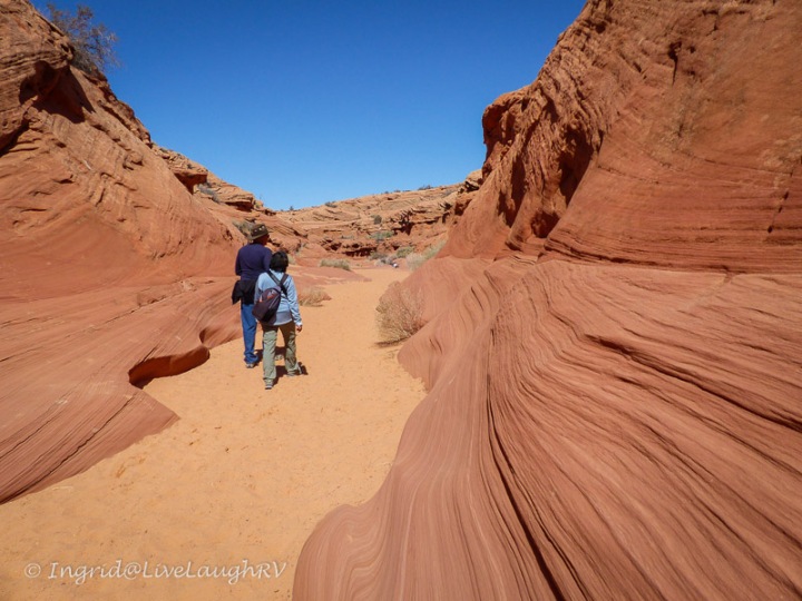
Eventually, the canyon starts to narrow … hence the term slot canyon. More oohs and ahs were heard!

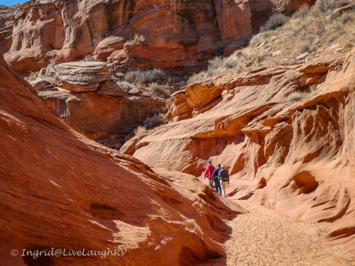
As the trail narrowed, there were a few obstacles for those of us a tad more vertically challenged. But we all excelled in our team-building efforts.

The most challenging part of the entire hike for me was that first ladder because it wasn’t quite tall enough for my comfort level. Thank goodness I had help at the top. Mona Liza needed help being pulled up as well.  The two ladders strapped together made for a rickety setup and we all took caution climbing it.

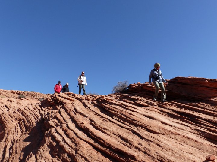
Once past the ladder, the slot canyon continued to wow us with its beauty. With three out of the six of us carrying cameras, there was plenty of stopping. With all the stopping to admire the canyon and snap photos, there was no cardio workout for this group.

Dave and I compare camera settings

Photographing a slot canyon can be a challenge due to the light, but that’s also what makes it so interesting. I’ve heard great things about the Native guides at Antelope Canyon instructing photographers on the best camera settings. Dave said he learned a  lot about his camera and the best settings from his guide when they hiked Upper and Lower Antelope Canyon a couple of years ago. Hmm, I may need to take one of those tours yet.

Depending on the time of day you visit, the colors of the rocks can vary greatly. So I highly recommend taking the time to admire the ever-changing light.

A word of caution …. Be sure to check the weather before embarking on any slot canyon hike. Remember how a slot is formed …. rushing water. You’ll want to avoid a flash flood, which can occur even if the rain is many miles away and upstream. This is not something to be taken lightly and even experienced hikers have lost their battle with a canyon flash flooding.

Once we reached the end of the trail (near the overhead power lines), it was time for us to turn around and view the canyon from a new direction. The hike is just as amazing on the return, but this is also when we started running into crowds. Seems as the day progresses, it can get busy.

Time to climb back out of the canyon. We need to join Al up there!

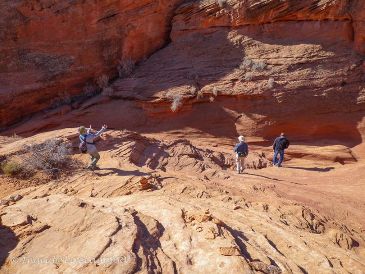
The climb back out of the canyon is a bit steep and this was another area where I was glad I wore good hiking shoes for traction. In the above photo, the hike up is around that bend and up to where Al is standing. Seems I failed to photograph the trail back up 😏

But here’s one of Dave’s photos showing us hiking down, and showcasing the kind of rock we had to walk on. This could get really slick if wet. As it was, the rock is dusted with sand and gets a little slippery in spots.

slot canyonWaterholes Canyon is about a 3-mile (total) out-and-back hike. I loved it! It was so much fun …. partly due to the stunning scenery but a bigger part due to the wonderful camaraderie.

Yep, this was one great hike … a great hike with great friends. Doesn’t get much better!

I’m so glad we rearranged our travels so we could all connect for this fantastic hike. Unfortunately, as full-time RVers, it’ll be a while before we bump into each other again. Seems we’re all heading in different directions this year.

Laughter and adventure near Lake Powell – Thanks for the memories!

slot canyons
Hiking a slot canyon with friends

Good humor is a tonic for mind and body. It is the best antidote for anxiety and depression. It is a business asset. It attracts and keeps friends. It lightens human burdens. It is the direct route to serenity and contentment. – Grenville Kleiser

As of May 2018, access to the Waterholes Canyon trail is limited. Permits are no longer being issued and a guide is required. The information regarding this trail is ever-changing and confusing. Please do your homework for the latest information before embarking on any hike on Navajo land.

Day Tripping in Idaho

Throughout the months of May and June, Al and I took full advantage of our days off from our work camping gig to explore parts of Idaho via a series of day trips.  The Sawtooth Mountains in Idaho are a sight to behold with their jagged and impressive mountain peaks, and just like so many other beautiful places we visit, photographs don’t always do justice to the majestic beauty laid before our eyes.

Exploring the back roads in central Idaho

We found Central Idaho to be a visual treat and an RVer’s delight with a ton of raw wilderness just ready to discover.  Finding a place to dry camp in remote national forest does not seem to be a problem around here.

Looking toward the quaint town of Stanley, Idaho
Sun Vally
Shopping – loved the European feel

One of my favorite day trips was a loop drive that took us about ten hours to complete.  We started at our home base in Arco, Idaho, and our first stop was the popular mountain town of Ketchum, also known as Sun Valley.

To get to Ketchum we had to drive through Hailey, Idaho, which I was particularly curious about.  Now mind you, I’m not one to get all caught up or go gaga over Hollywood celebrities, but I do have a curiosity about the lives they lead behind the scenes.

Back in the 1990’s when Demi Moore and Bruce Willis started growing their family, they moved to Hailey to escape the Hollywood scene and helped rebuild this struggling little town.  “Why Hailey”, I questioned?  What made this little town so desirable to a couple who financially could afford to live anywhere.  After driving around the town of Hailey …. up one street, down the other on more than one occasion, I don’t have an answer.  Although cute, it certainly wouldn’t be my first choice if money were no object.

Maybe its more about Sun Valley.

Sun Valley Idaho

Sun Valley is a popular winter destination with its challenging ski slopes and European Nordic feel.  However, Sun Valley Idahomoderate weather, wonderful biking and hiking trails, and an eclectic variety of dining options, makes Sun Valley equally popular during the summer months.

Expensive second homes dot the landscape.  The elegant mountain style architecture blends in beautifully with the terrain of rolling, flowersgrassy hills.

Wildflowers speckle the hillsides with color while gardens filled with flowers adorn well manicured yards.  I loved the abundance of flowers seen in all directions.

Although I found the area to be charming, I somehow felt disappointed.  After visiting so many mountain resort towns in Colorado, perhaps I was expecting an unrealistic wow factor.   Various places resonate differently with each of us and just because I wasn’t feeling it, doesn’t diminish its allure or beauty.

Sawtooth MountainsThe mountains around Sun Valley are unimposing, but from what I hear, are steep and challenging for skiing enthusiasts.  Our time in Sun Valley was brief and we didn’t get a chance to hit the trails to really delve into the lay of the land as much as we would’ve liked.

While strolling the streets of Ketchum, we found folks to be particularly friendly and helpful.  And unlike the mountain towns in Colorado, Sun Valley was not crowded.  Let’s face it, it does take some considerable effort to get to this part of the country.The Kneadery

I must share …. we enjoyed a fabulous lunch at The Kneadery  located in downtown Ketchum.  I’m all about décor and atmosphere along with fresh wholesome ingredients and The Kneadery hit the spot perfectly; cute place, a tasty meal, at a reasonable price – highly recommend.Sawtooth MountainsWith tummies full, it was time for us to meander north.  As the road twisted and turned, it wasn’t long before we were greeted by those craggy, snow speckled Sawtooth Mountains.  What a stunning mountain range!  We passed numerous places to dry camp, and as much as we wanted to stop and check out the possibilities, I was on a mission to get to our next stop.Redfish Lake

Redfish Lake ….  Wow!  Thanks Donna and Char for insisting I visit this place.  I haven’t seen such turquoise and pristine waters since I last visited the Caribbean. Redfish Lake

I could’ve sat at that beach for hours admiring the view.  I may not have been feeling it in Sun Valley, but I sure as heck was feeling it at Redfish Lake. The beauty of our surroundings had Al and me feeling somewhat nostalgic  as memories of our Caribbean trips were conjured up.  Then there are the memories of us paddling our canoe in northern Minnesota or taking our kids out on our fishing boat in southern Utah.  Yep, we’re lake people and a beautiful body of water always brings a smile to our faces.Redfish Lake

Al and I grabbed a snack and a drink from the cooler and found a spot to sit.  We initially sat in silence as we watched the kayakers and stand up paddle boarders paddle by.  Sigh!  Oh how I longed to be out on that water.  Al and I reminisced about our boating days and although there are many aspects about those days that I miss,  I somehow felt incredibly content and fortunate to be relaxing on the shore admiring that view.Redfish Lake

We were quite smitten with Redfish Lake and the quaint town of Stanley.  It is breathtakingly, mesmerizingly, beautiful here! It was tough to pull ourselves away, but return home we must ….. though not before checking out the campground for future reference. This area made our “return” list, which I’ll admit, seems to get longer the more we travel.

Thanks Donna and Char. I’m so glad we made it a priority to visit Redfish Lake.  If there’s one place in Idaho I’d say is a ‘must see’, this would be it.

The scenery along the way was every bit as memorable as the stops

Now it was time to complete our loop drive with one more exploratory stop before reaching home.

Mackay Reservoir - boondocking along the shores is a consideration
Mackay Reservoir – boondocking along the shores is a consideration

Mackay, Idaho: from a former mining town to a small recreation town …. folks escape the big cities (big for Idaho, that is) to come to Mackay on the weekends to get away and relax.  The water (my personal fav) and back country 4×4 roads are the draw for this rustic and remote area.

colorful mountains around Mackay, Idaho

For now, we need to head back to camp, but we’ll visit Mackay in the next post!

Idaho

All that water we saw has me eyeing one of these inflatables… hmm! Christmas is coming – wink, wink dear hubby 🙂  Perhaps there will be plenty more boating adventures in our future!

The Good, and the not so Good

Tortilla Flat 
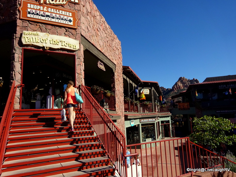
Hubby and I have settled into life here in Phoenix, Arizona, nicely.  Our first month back in the Valley of the Sun whizzed by…. enjoying exploratory outings with our daughter, socializing with neighbors, and connecting with friends, old and new.

The good:  We see our son and daughter every weekend when they stop by the RV and allow me to make them breakfast.  I’ve been having a grand ole time taking it up a notch in the kitchen and everyone is appreciative of my efforts.  Although the constant photographing of food is something they’d like me to tone down a tad 😉Breakfast

I had a blast spending the first two weeks in October with our daughter, Ashton, getting her acclimated to her new home.  I was eager to show her as much of the area’s unique beauty before she had to start her new job.

One of my favorite places around Phoenix can be seen in the far southeast side of the valley; the Superstition Mountains and the Apache Trail.  In my opinion, no visit to Phoenix would be complete without a visit to this area.

approaching the Superstition Mountains

After a one hour drive from our RV Park in the northwest part of the valley to the Superstitions in the southeast valley, we took a quick spin through the Lost Dutchman State Park so I could point out the awesome hiking trails…… trails that I plan to tackle soon.  I wanted Ashton to be as excited about hiking here as I always am.

Canyon Lake
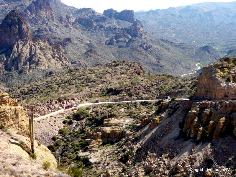
From Lost Dutchman State Park we continued on the Apache Trail (aka 88) along a paved, winding road.  Ashton was happy to see a road that could be compared to similar roads in Colorado; you know…. the kind that climb, turn, and have drop offs with no guard rails.  She was feeling quite comfortable and not concerned even after passing a tow truck winching a vehicle up from the canyon below.  Eek, someone obviously had a bad day.  Good idea to take this road slow.

Canyon Lake
Canyon Lake

Fourteen miles north of the town of Apache Junction is picturesque Canyon Lake.  Ashton and I have already discussed renting a couple of kayaks and getting out on the water one of these days, and I know our friends, G & T, would love to join us.

Just a little further up the road is the quaint tourist attraction, Tortilla Flat.  We grab a bite to eat in the rustic restaurant and after lunch we stop in the general store for ice cream and fudge.  They are known for serving up the best ice cream around….yum.  Don’t pass it up!

With tummies full, we continued our drive toward a scenic overlook.  The pavement ends and we stir up a huge cloud of dust as we travel on a dry gravel/dirt road.  Ashton isn’t sure how she feels about the landscape and thinks it’ll take some time for her to get used to it.

Tonto National Forest

When I tell her we are in the Tonto National Forest, she scoffs and with a smirk says, “I’m sorry, but this is not a forest”.

Say what? Don't be dissing my forest.
Say what? Don’t be dissing my forest.

The desert can be an acquired taste, especially for those more accustomed to a lush landscape like that found in the Midwest or Pacific Northwest.  Some folks never adjust, but I know Ashton will eventually come around and embrace the stunning beauty observed in the desert, just as I have.Tortilla Flat

What’s interesting; when we were back in the Midwest this past summer, the dense vegetation started irritating hubby and me.  We had no vistas.  Way too many trees.  We even had a tree damage one of our sky lights, which we’ll be replacing soon.  Although I must admit, Al did a fabulous job using white duct tape to fix up the crack.  It doesn’t even look patched.  Yep, I don’t miss having trees around.Tonto National ForestI have lots more good to share in upcoming posts, but for now, let’s get onto the not so good.

Birds#1 – I’ve been fighting a nasty cold that has put me in a foul mood.  An unsociable mood.  I’ve been sick way too much this past year, and it’s curtailing my fun.  Talk about frustrating!

#2 – And to add insult to injury, my internet connection is sporadic putting a crimp in my blogosphere habit.  I haven’t been able to post or comment as usual and in some cases I can’t even hit the “like” button.  Double frustrating.

Oh well, this too shall pass…. after all, tomorrow is another day!

Welcome to Our Campsite Where Friends & Marshmallows Get Toasted At The Same Time Camping Sign Plaque 5″X10″
LEGO City Great Vehicles 60057 Camper Van

Therapy comes in many forms

The intoxicating beauty of towering red rock sandstone monoliths and buttes…. rocks aptly named Coffee Pot Rock and Cathedral Rock…. equal parts of rugged and luxury….  a small town blessed with an abundance of beauty and surrounded by National Forest land…..Sedona, Arizona

These words barely begin to personify stunning Sedona, Arizona.  Sedona served as stop number two for my excursion with my daughter, and as you might expect, it did not disappoint.  Ashton was pleasantly awed by the angular rock formations, high mesas, and stunning colors.  Sedona

Talk about a visual treat.  A feast for the eyes.  An abundance of beauty in all directions.

SedonaThose beautiful red rocks serve as a backdrop for a number of outdoor activities ranging from spiritual pursuits to hundreds of hiking and biking trails to guided Jeep excursions.

Lots of great dining options

Since Ashton and I only had a couple of hours to tour the area, we set our sights on exploring the shops.  Sedona is well-known for its vortex energy and folks from around the world come here for healing and spiritual renewal.

SedonaMany of the shops focus on the metaphysical and sell jewelry made from various crystals and stones, each serving a distinct purpose.  We stepped into the Sedona Crystal Vortex shop and found ourselves learning the metaphysical value of the array of polished stones.  The store offered everything from loose stones, to stunning pieces of jewelry that I would classify as “Art”, to simple elasticized bracelets. Sedona

As we perused the numerous bracelets, we read the special benefits of wearing particular stones.  It seems there’s a stone for whatever ails a person.


SedonaMy skeptical nature may have had me doing an eye roll, but the bracelets were cute and thus I figured what the heck.  It certainly couldn’t hurt to wear one of these ‘healing‘ bracelets and I can always use a little help.  Hmm….. I pondered which stone(s) would be most beneficial for me;   creativity, energizing, harmony, inspiration, courage, grounding, prosperity, calming, balance?  The list went on, and although I was tempted to walk out of there with half a dozen bracelets, my wallet thanked me for walking out empty-handed.  Perhaps I should have indulged in a citrine stone bracelet = prosperity!

Ashton, on the other hand, found healing and inspirational therapy at a wine shop.  Following a little wine tasting, she walked out of the store with two bottles of Arizona wines.

Sedona

We spent another hour engrossed in retail therapy before heading off for a little spiritual enlightenment.Chapel of the Holy Cross

Regardless of one’s faith, a visit to the Chapel of the Holy Cross is a must.  Built in 1956 this Catholic Chapel rises 70 feet (21m) out of a 1,000 foot (300m) red rock cliff.

Sedona

I must admit, a quiet moment of reflection inside this church had more of an impact on my aura than any of the crystals or healing stones I handled that day.  Perhaps my chakras are in need of attention.

On that note, I know just the place to go to have my chakras aligned, engage in vortex energy, have my aura analyzed, or purchase stones to help heal whatever ails me 😉  Yes, Sedona…. I shall return.  I’m itching to hit your trails!

Sedona

Before heading out of town, we made one final stop.  Not only had I worked up a thirst, but I felt compelled to show Ashton the architecture on this one of a kind McDonald’s. Sedona Yep, this is the only McDonald’s in the world where the arches are turquoise instead of golden.  So when I told her we were stopping at the Turquoise Arches for soft drinks, she was initially perplexed and later humored.

Crystal Healing
November’s Chopin Fashion Handmade Metal Leaf Pendant Wood Prayer Bracelet Link Wrist Necklace

Devils Doorway

It didn’t take long before Illinois was in the rearview mirror and we were skirting around Madison, Wisconsin, heading north.  After three weeks in Illinois, we were ready to hit the road and explore a new to us State Park.

Devil's Lake State Park
The entrance to Devil’s Lake State Park and camper check-in

As we approached the entrance to Devil’s Lake State Park, we were quickly reminded about how lush and dense the vegetation grows here in the Midwest.  The trees created such a unique canopy that it blocked out any direct sunlight requiring the truck headlights be turned on.

Wisconsin State Parks
We’re in site #51 – the Quartzsite Loop

We proceeded slowly through the entrance following the signs directing us toward the camper check-in, ever hopeful that no tree branches would scrape our roof.  I was confident we wouldn’t have any problems with vegetation once we arrived at our campsite that I had reserved, heeding the wonderful advice and recommendation from Wisconsin State Parksour good friends, MonaLiza and Steve.

They camped here last year and found the majority of campsites to be unacceptable for their big rig.  They provided us with lots of helpful tidbits making our reservation decisions much easier.  Thanks guys!

I’m not a fan of trees near my RV, so I was thrilled to find all the trees at a safe distance.  Our site was also easy for us to level up.  The majority of sites are sloped in some form, making leveling a challenge.  There’s a handful of paved sites in the Quartzsite Campground and the rest are a gravel/grass combo like our site.

Devil's Lake
This is the road to the other campground loops.

On our first full day at the State Park, we set off on a hike in search of Balanced Rock and Devil’s Doorway.  I don’t know about you, but I thought the entrance to the park might have been Devil’s Doorway.  But alas, this unique rock formation is named Devil’s Doorway.

Devil's Doorway
Rock formation named Devil’s Doorway

To get to this scenic site required a little climbing on our part….. step climbing that is. Devil's Doorway We had about a 500 foot ascend in front of us.  Fortunately, we had a series of granite rock steps to aid us in the climb.  When the trail info listed this hike as difficult, I kind of dismissed any concerns.  After all this was Wisconsin, and I’m used to hiking in Colorado.  Thus, I thought difficult here would probably be more like moderate in the mountains.

Devil's Doorway
It’s all uphill

hikingI must admit, the trail did rival some Rocky Mountain trails, but what made this hike somewhat easier was the extra oxygen found here in the Midwest.

When we’re in Colorado, it’s not uncommon for us to hike at elevations exceeding 9,000 feet and the air starts to get a little thin requiring me to stop and catch my breath from time to time.hiking in Wisconsin

hiking in Wisconsin
The trail starts out flat meandering through a dense forest,

Hubby and I were impressed with ourselves.  Other than the occasional photo-op stop, no breathing stops were needed.  We did take it slow though, not wanting to lose our balance on the granite stone.

Our day started out sunny, but windy.  By the time we made it up to Balanced Rock, the winds had let up somewhat but storm clouds were brewing.

Balanced Rock
Al and I standing in front of Balanced Rock high above Devil’s Lake – Baraboo, Wisconsin
happy camper
Look who found a bench at the top of the bluff

We thought once we made it to Balanced Rock that the trail would level off…. wrong.  There were more steps to climb.  “We’re almost there, honey. Not much further and we’ll be at the top”, I said in a very encouraging and sweet tone.  Hubby responded with a disbelieving chuckle, “Yeah, that’s what you said 20 minutes ago”.

Alas, we made it to the top of the bluff and the trail flattened out.  Hubby even found a bench for us to sit while we hydrated.

With Balanced Rock checked off, I had one more quest that required a short detour off the main trail.  Ladies first!

Devil's Doorway
Hmm, I need to hike DOWN there? Going down to Devil’s Doorway.

What’s in a name?  The original Native American name for Devil’s Lake could have been translated as Spirit Lake, Holy Lake, Mystery Lake, or Sacred Lake.  But the Winnebago name “Ta-wa-cun-chuk-dah” was translated into Devil’s Lake by locals and legends were manufactured to boost tourism to the area.Devil's Doorway

The view was worth the climb via the precarious rock steps.  With photo-op quest number two accomplished, we worked our way back to the main trail and were met with a gentle sprinkle of soft raindrops followed by a steady flow.  My camera was safely stowed in a Ziploc bag and tucked under my raincoat.hiking in WisconsinAl and I quickened our pace on the flat trail.  The rain stopped just in time for us to descend.  However, the wet granite from the rain was now somewhat slippery.  So we continued with extra caution on each rock step and made it to the trailhead without any harrowing tale to share on the blog.  Just the way hubby likes it!hiking in Wisconsin

This was a wonderful 2 hour hike and probably our favorite Midwestern experience thus far.  Next up, feathers…. and lots of them!

NFL Green Bay Packers Clean Up Adjustable Hat, Dark Green, One Size Fits All Fits All
Moon Wisconsin (Moon Handbooks)


The Apache Trail

Are you an adventurous traveler?  Are you looking for a scenic memorable drive?  Well, I’ve got just the day trip for you.  Al and I first drove this 80 mile scenic loop three years ago and it still ranks as one of our favorite day excursions.Salt River AZ

On the far southeast side of the greater Phoenix area lies Arizona’s oldest highway. This former stagecoach trail which runs through the Superstition Mountains was Lost Dutchmanoriginally used by the Apache Indians thus aptly named The Apache Trail.

The Apache Trail is officially known as State Route 88 and links the town of Apache Junction with Theodore Roosevelt Lake.  The trail was developed into more of a road in the 1930’s to support the development of dam’s along the Salt River creating some beautiful lakes in the process.

There’s a bunch of interesting sights and views along the way which necessitate lots of stopping.  Photo-op anyone?  Thus, the Apache Trail Circle Loop requires an entire day for the excursion.  It’s also not for the faint of heart, which I’ll explain in a minute.Apache Trail

We’ll start our journey from the town of Apache Junction and head north on State Road 88, aka The Apache Trail.  Our first stop is the Superstition Mountain Museum.Superstition Mountain Museum

The museum collects, preserves, and displays the artifacts, history, and folklore of the Superstition Mountains.  Even though we knew we had a long day in front of us, this  picturesque place is worthy of a photo-op and stroll around the historic buildings. We’ll tour the museum another day.

Moving on; our next stop is the Goldfield Ghost Town.  Goldfield was once a happening gold mining town back in the 1890’s. I found myself on more than one occasion visiting this little tourist attraction.  There’s free parking and free strolling around, but there is a fee for each attraction.  You can click on this link for more info on attractions. We don’t usually do the ‘tourist’ thing so I can’t vouch for any of the paid attractions.Superstition Mountains

The quaint little shops offer unique trinkets as well as the usual tourist stuff.  The grounds are loaded with original mining equipment.  It’s obvious these are the original buildings and have been standing for a very long time.  As a matter of fact, a museum building was closed while construction workers were busy shoring up a second floor balcony.

As I strolled around Goldfield Ghost Town, I could almost visualize the harsh realities of life over 100 years ago. These were hardy folks living in an unforgiving and harsh environment.  I also found it funny that the Bordello was located near the church.

For those unable to secure a campsite at the Lost Dutchman State Park, Goldfield Ghost Town does have a campground.  It’s a bit rough, but at least it’s a place to park in a pinch.

Lost Dutchman State ParkAnd speaking of Lost Dutchman State Park, which is just a little further up the road;  we discovered some of the best hiking trails at this park.  We take full advantage of these trails anytime we’re in the area.  There is a day use fee unless you are already camped in the park.  Lost Dutchman State Park requires it’s own day to explore and it’s own blog post.  And I highly recommend camping here.

Continuing on our journey the road starts to climb, twist, and bend. Shortly after passing the state park we enter the Tonto National Forest.  The scenery becomes more rugged and stunning with each mile.  March is particularly beautiful as the road is lined on both sides with yellow blooms from the brittle bush and desert marigolds.

Twenty miles north of the town of Apache Junction, we round a bend and are graced with the sight of an oasis in the desert.  Canyon Lake with it’s deep blue waters surrounded by rugged cliffs and rocky terrain is a pleasant and unexpected surprise.Canyon Lake AZDefinitely worth a few photo-ops around here.  Canyon Lake in itself is a great day excursion; perfect for a picnic, kayak adventure, or even a cruise aboard the Dolly Steamboat.Canyon LakeTortilla FlatA few more miles up the road is the cute little town of Tortilla Flat – population 6.  This is the perfect place to stop for lunch.  The restaurant serves up great burgers and has a fun décor.

We recently revisited with friends and in the photo you can see dollar bills stapled to the walls along with old mining tools and historical photos. The bar stools are saddles and the little general store serves up some of the best ice cream and fudge around.

With tummies full, it’s time to brace ourselves for the truly adventurous part of the drive.  Just past the town of Tortilla Flat the pavement ends.  Most rental car companies will not want you driving this road and it’s not recommended for any vehicle over 25 feet in length….  Definitely no RV’s!

Apache Trail
The Apache Trail runs through rugged desert terrain

Apache TrailThe gravel road is wide and in pretty good condition up to the scenic view parking lot.  Obviously the vista is worth a view and for those less adventurous this would be a good place to turn around and retrace your journey home.

For us? Al and I are used to driving unpaved mountain back roads with steep cliff drop-offs with no safety barriers or guardrails.  In other words, the stretch of road between Tortilla Flat and the Roosevelt Dam is not for the faint of heart.

As we continue past the scenic overlook the road narrows and winds.  This two way traffic road narrows down to about a one to one and a half lane wide road.  Those going down hill supposedly have the right of way and it’s not uncommon for the need for someone to back up to a wider spot in the road so vehicles can pass by each other.  Fish Creek Hill/Pass is the worst part of the journey with sheer drop offs, very narrow, lots of turns, and a steep elevation change.Apache TrailOne lane bridges and a washboard gravel road add to the overall adventure. Once we reach Apache Lake, another beauty, the road becomes a little easier to traverse.  Due to the washboard condition of the road and our extra long wheel base on the F-250, it’s slow going.  Two and a half hours after leaving Tortilla Flat we finally arrive at the Theodore Roosevelt Damn and Lake.

Apache Lake
Apache Lake
Tonto National Forest

We tour the campgrounds and the boondocking opportunities and are pleasantly surprised.  We will definitely be keeping Roosevelt Lake as a possible place to camp in the future.  It’s pretty.  It’s remote.  It’s inexpensive.  It’s located within the Tonto National Forest, although the word ‘forest’ is a relative term.  You won’t find any of the usual trees around here.  This is still the desert.

poppiesThe majestic scenery continues from Roosevelt Lake to the active mining towns of Miami and Superior and onto the Boyce Thompson Arboretum.

By this point in the journey, I’m photoed out, tired, and just ready to get home.  We make notes for things to see and do in the future.

Whether one is looking for solitude or a host of activities, this part of Arizona seems to offer it all.  I remain in awe by it’s raw beauty and fascinated by the plants and animals that survive in this harsh land.

Hmm… whatever shall we do tomorrow?Apache Trail

Wild in Arizona: Photographing Arizona’s Wildflowers, A Guide to When, Where, and How

Arizona Ghost Towns and Mining Camps/a Travel Guide to History