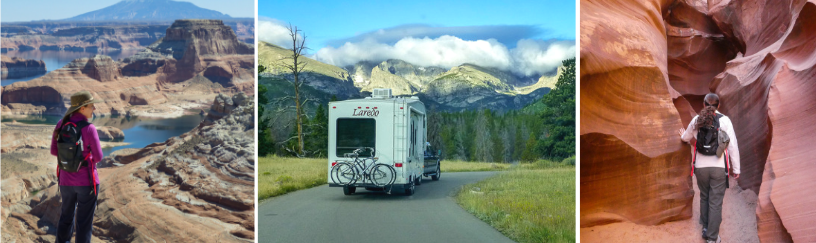
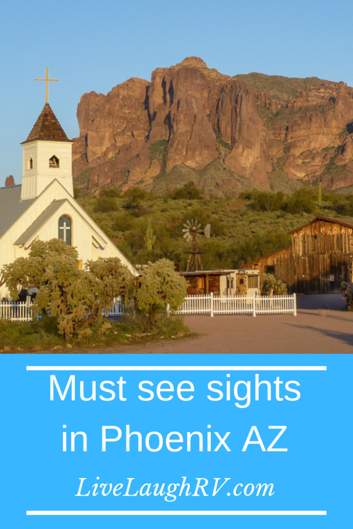
Are you an adventurous traveler? Are you looking for a scenic memorable day trip near Phoenix, Arizona? Well, I’ve got just the day excursion for you. Al and I first drove this 80 mile scenic loop several years ago and it still ranks as one of our top favorite day trips in Arizona.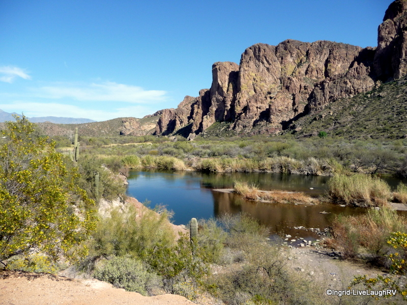
Arizona History
On the far southeast side of the greater Phoenix valley lies Arizona’s oldest highway. This former stagecoach trail which runs through the Superstition Mountains was 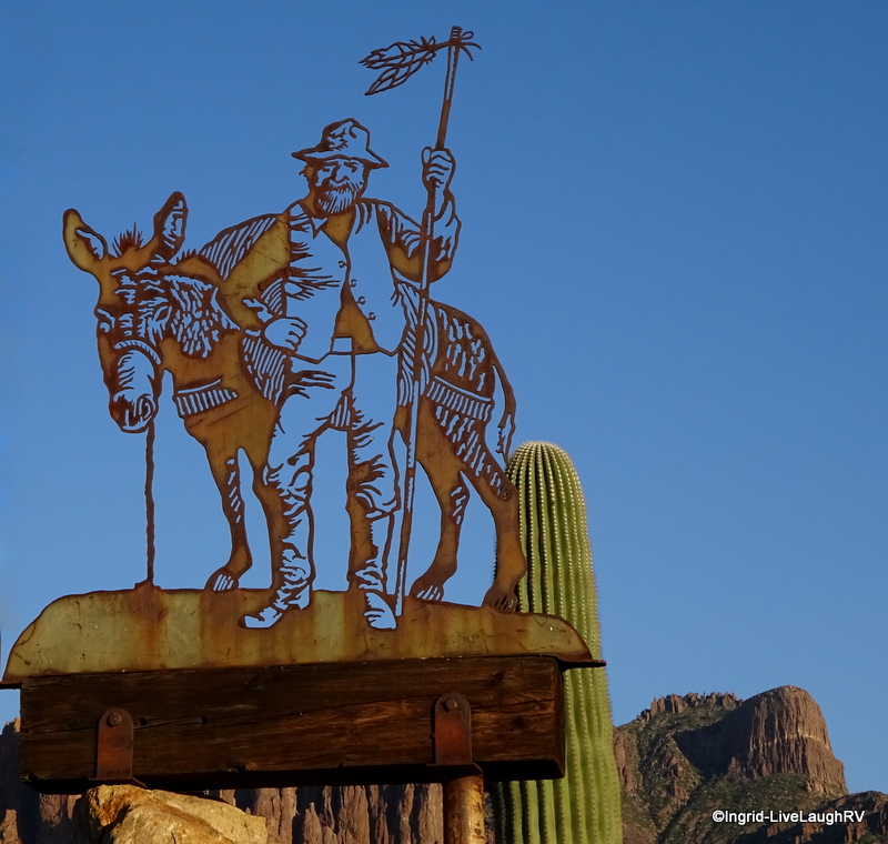 originally used by the Apache Indians, thus aptly named The Apache Trail.
The Apache Trail is officially known as State Route 88 and links the town of Apache Junction with Theodore Roosevelt Lake.
The trail was developed into more of a road in the 1930’s to support the development of dam’s along the Salt River, creating some beautiful lakes in the process.
There’s oodles of interesting sights and beautiful views along the way which necessitate lots of stopping. Photo-op anyone? Thus, the Apache Trail Circle Loop requires an entire day. It’s also not for the faint of heart, which I’ll explain in a minute.
Be sure and pack a lunch, snacks, and plenty of water because you’ll be exploring some desert backcountry during this scenic day trip drive. It helps if you have a high-clearance vehicle, but we saw plenty of regular cars on the dirt portion of the road from Tortilla Flat to Roosevelt Lake. That doesn’t mean I’m saying a basic car is a good fit for the terrain. It means, I saw regular cars navigating without apparent issue.
My recommendation; be sure it didn’t rain the day before, take your time, watch for bumps, and be prepared for washboard road conditions. When in doubt, check with a Tonto National Forest Ranger for further clarification and up to date road conditions.

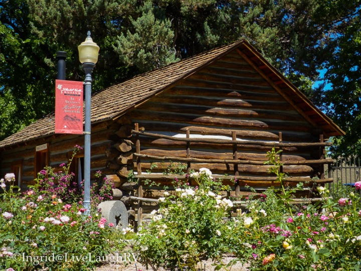
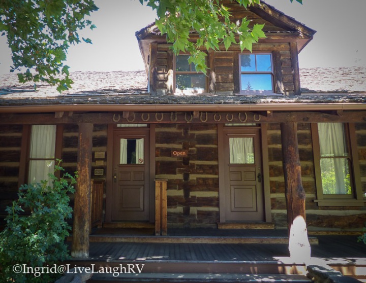
We’ll start our journey from the town of Apache Junction, Arizona, and head north on State Road 88, aka The Apache Trail. Our first stop is the Superstition Mountain Museum.
A picturesque museum
The Superstition Mountain Museum collects, preserves, and displays the artifacts, history, and folklore of the Superstition Mountains. Even though we knew we had a long day in front of us, this picturesque museum is worthy of a photo-op and stroll around the historic buildings. We made a note to tour the museum another day.
Exploring a Ghost Town
Just a short drive north of the Superstition Mountain museum is our next stop; the Goldfield Ghost Town. Goldfield was once a happening gold mining town back in the 1890’s. It’s now a popular tourist attraction which is rooted in Arizona history. It’s a fun and interesting stop. They still actually mine gold here, but that’s blocked from public view. Guess they don’t want to share them there gold, huh!
Goldfield Ghost Town offers free parking and free walking around, but there is a fee for each attraction. You can click on this link for more information on those attractions. We don’t usually do the tourist type of thing, so I can’t vouch for any of the paid attractions.

The quaint little shops at the Goldfield Ghost Town offer unique trinkets specific to the area along with the typical tourist stuff … T-shirts, shot glasses, coffee mugs, postcards, etc. The grounds are loaded with original mining equipment, and it’s obvious, these are the original buildings and have stood for a very long time. As a matter of fact, during our visit, a museum building was closed while construction workers were busy shoring up a second floor balcony.

As I strolled around Goldfield Ghost Town, I could envision the harsh realities of life over 100 years ago. These were hardy folks living in an unforgiving and harsh environment. However did they survive living in the desert without air conditioning? And no A/C in that covered wagon either 😱


I found it funny that the Bordello was located near the church. How convenient is that? Play hard …. pray even harder. Sow your wild oats on Saturday, and pray for crop failure on Sunday!


During this particular visit to the east side of the Phoenix area, we happened to be camped just up the road from the Goldfield Ghost Town at one of our favorite campgrounds; the Lost Dutchman State Park. For those unable to secure a campsite at the Lost Dutchman State Park, Goldfield Ghost Town does have a campground. It’s a bit rustic, but at least it’s a place to park the RV in a pinch.
A favorite state park
 Speaking of Lost Dutchman State Park, this is one of our favorite places to camp while visiting the Phoenix valley.
The hiking trails are amazing and the campsites are comfortably spaced. And the views are absolutely stunning!
For those interested in visiting the Lost Dutchman State Park but not interested in camping, there is a day use area. For a small fee, you can enjoy the trails all day. The day use area offers plenty of shaded picnic tables, restrooms, and easy access to all the trails. Seriously, this is a “must see” place during any visit to Phoenix, Arizona, especially in March when the wildflowers are blooming.
A beautiful body of water in the desert
As we continue our scenic drive north of the state park, the road starts to climb, twist, and bend. I highly recommend driving this stretch of road without an RV for the first time due to potential length and height issues.
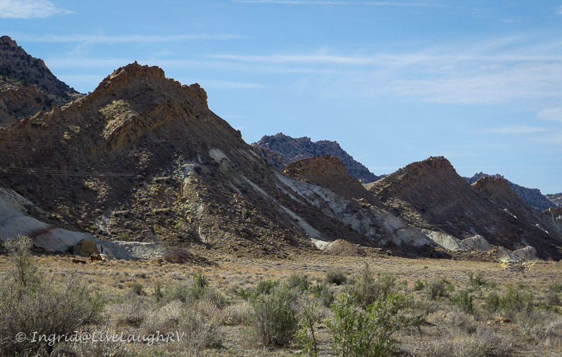
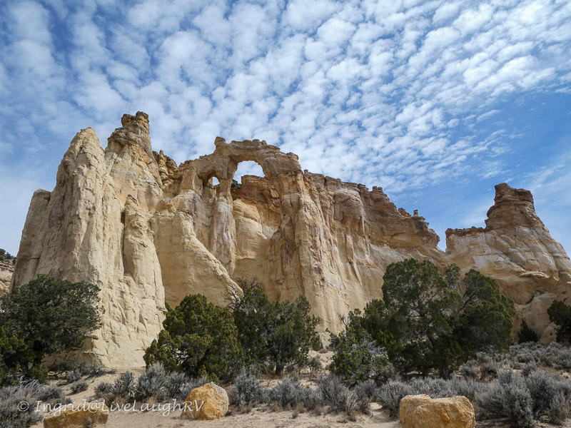
Shortly after passing the Lost Dutchman State Park we enter the Tonto National Forest. The scenery becomes more rugged and stunning with each new mile. March is particularly beautiful as the road is lined on both sides with yellow blooms from the brittlebush and desert marigolds.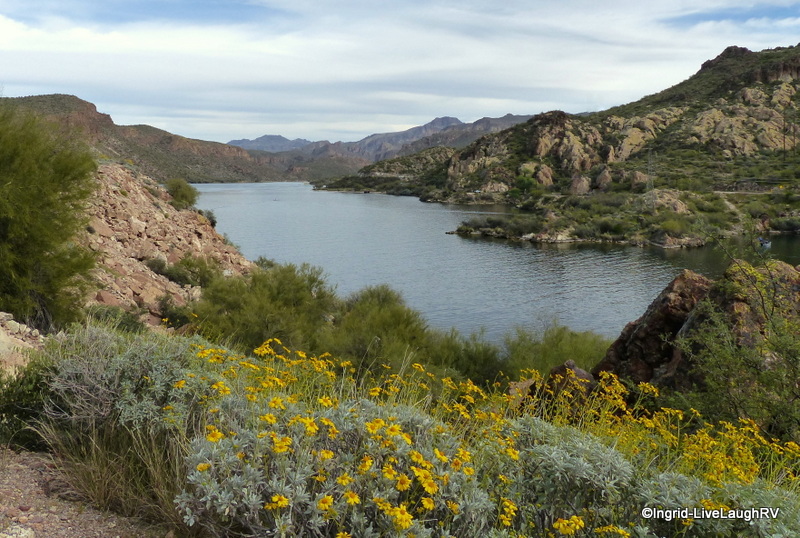
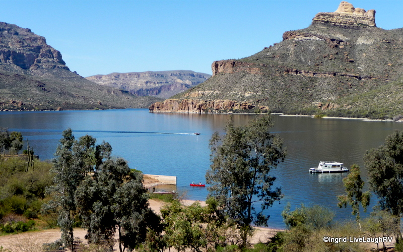
Twenty miles north of the town of Apache Junction, we round a bend and are graced with the sight of an oasis in the desert. Canyon Lake with it’s deep blue waters surrounded by rugged cliffs and rocky terrain is a pleasant and unexpected surprise.
Definitely worth a few photo-ops around here, wouldn’t you agree? Canyon Lake itself is a great day excursion; perfect for a picnic, kayak adventure, or even a cruise aboard the Dolly Steamboat.

Canyon Lake offers a marina for daily boat rentals; powerboat, kayak, and even SUP’s (stand up paddle board). There’s also a campground, but it is rather pricey for what you get, in my opinion anyway. The last time I checked, it was over $50 a night. With that said, the drive is also something to consider. It could be quite challenging for larger RV’s due to length and height. Considering we all travel with different types of RV equipment and have our own comfort level, I recommend checking it out first without the RV.
A town with the population of 6
A few more miles up the road, past Canyon Lake, is the cute little town of Tortilla Flat – population 6. This is the perfect place to stop for a bite to eat, especially if you forgot to pack a meal, like we did. The restaurant serves up great burgers and has a fun décor.


(to enlarge photos in a gallery, simply click on any image)
The walls are covered with dollar bills stapled all over, as well as old mining tools and historical photos. The bar stools are saddles and the ladies restroom has entertaining painted stall doors. I think this is the one and only time that my daughter allowed me to photograph her in a restroom. I had to bribe her with ice cream. The little general store serves up some of the best ice cream around and the fudge was pretty good also.
The adventure begins
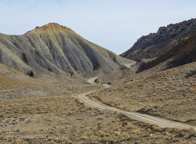
 With tummies full, it’s time to brace ourselves for the truly adventurous part of the drive. Just past the town of Tortilla Flat, the pavement ends.
Most rental car companies will not want you driving this road and it’s not recommended for any vehicle over 25 feet in length…. definitely no RV’s. Although, we did notice some guys pulling their boats 😮
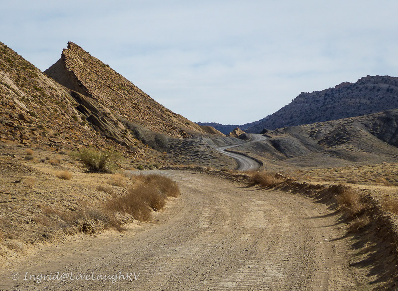
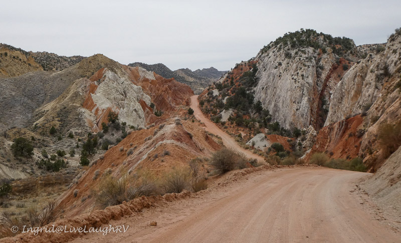
The gravel road is wide and in pretty good condition up to the scenic view parking lot. The vista and scenery is worth the dusty, bumpy gravel road to get to it. For those less adventurous, this would be the perfect place to turn around and retrace your journey home. In my experience, the gravel road from the town of Tortilla Flat up to the scenic overlook is usually in good condition for any vehicle to navigate, but beyond that point, it can get dicey and very interesting.

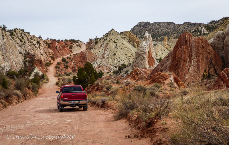
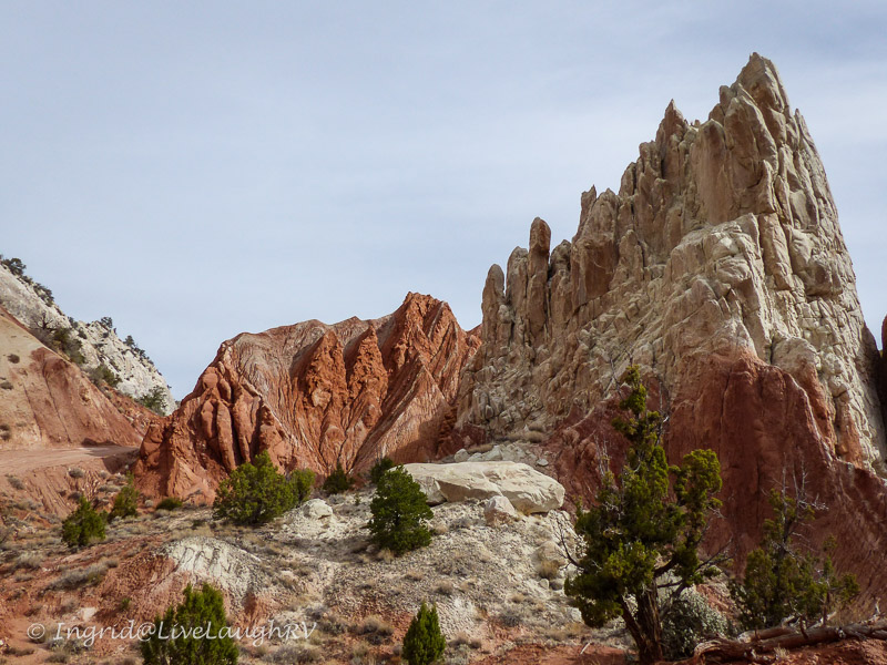
Al and I are used to driving unpaved mountain backcountry roads with steep cliff drop-offs with no safety barriers or guard rails. In other words, this next stretch of road between the scenic overlook and Apache Lake is not for the faint of heart. (Tip: if you’re interested in visiting Apache Lake, but don’t want to drive over Fish Creek Hill, access from Roosevelt Lake. The road between Roosevelt Lake and Apache Lake is much easier to navigate and without the high drop-offs.)

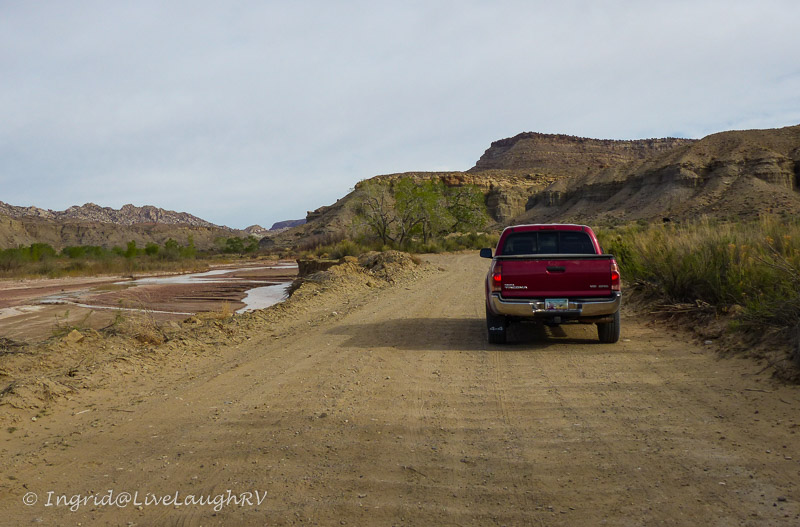
As we continue past the scenic overlook the road narrows and winds. This two-way traffic road narrows down to about a one to one and a half lane wide road. There isn’t enough room in most spots for two vehicles to pass each other. Those going down hill supposedly have the right of way and it’s not uncommon for someone needing to back up to a wider spot in the road so vehicles can pass by each other.
Fish Creek Pass, aka Fish Creek Hill, is the worst part of the journey with sheer drop offs, a very narrow road, lots of turns, and a steep elevation change. Fish Creek is the most stressful and challenging part of the drive and not for the faint of heart. Once we navigate Fish Creek Hill, one lane bridges and washboard road conditions continue to add to our adventurous day.
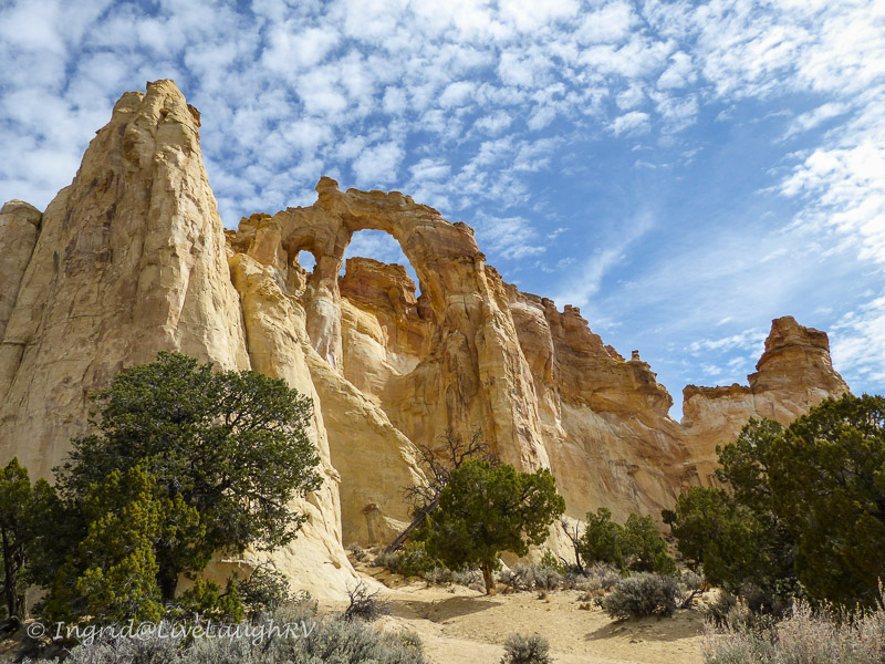
Apache Lake
Once we reach Apache Lake, another beautiful oasis in the desert, the road becomes a little easier to traverse. Due to the washboard condition of the road and our extra long wheel base on the F-250, it was very slow going for us. This is when my Tacoma or a Jeep would be perfect, but my Tacoma was back in Colorado during this excursion. Even a Honda CRV would’ve been a better choice for this road than the long wheel base of our Ford truck.
Two and a half hours after leaving Tortilla Flat and 22 miles of gravel road later, we finally arrived at the Theodore Roosevelt Damn and Lake. We averaged about 10 miles per hour with lots of photo-op stopping along the way.

We leisurely tour the campgrounds and the boondocking opportunities along the lake shore. We are pleasantly surprised and make notes. We will definitely keep Roosevelt Lake as a possible place to camp in the future. It’s pretty. It’s remote. It’s inexpensive, and located within the Tonto National Forest.
I’m entertained by using the term “forest” around this barren looking land. You won’t find any of the usual trees that most folks would expect in a National Forest.This is still the desert and you’ll find a forest of saguaro cactus and their cousins in lieu of any oak or aspen trees.

This unusual forest may look barren at first glance, but upon closer inspection, you’ll discover an amazing ecosystem with the ability to survive and flourish in some of the harshest weather and terrain.
The beautiful scenery continues
 The fascinating and majestic scenery continues from Roosevelt Lake to the active mining towns of Miami and Superior and onto the Boyce Thompson Arboretum.
Oh, how I wanted to stop at the Arboretum, but by this point in our journey, we were tired, photo outed, and ready to just get home. Besides, the Boyce Thompson Arboretum would require its own day.
There are so many interesting sights along this scenic loop that we wanted to stop and explore further, but we realized we couldn’t see and do it all in one day.
We took notes for future day excursions, as well as future overnight RVing spots and promised ourselves to return again and again. I always look forward to spending time in the Phoenix valley. Whether one is looking for solitude or a host of activities, this part of Arizona seems to have it all, and it rarely disappoints.
I remain in awe by Arizona’s raw beauty and fascinated by the plants and animals that survive in this harsh land. What an adventurous day we had!
(affiliate links)
Picnic Bag Backpack
Amazing Places National Parks Game
“Love Pie” Pie Irons
Cooking Up S’more Campfire Fun
Marshmallow Roasting Sticks – Telescoping
Stainless Steel Travel Tumbler with Lids


 In 1817, John Adams complained that America seemed uninterested in its past. After the War of 1812, the Federalist party began to come apart and the new parties of the 1820s and 1830s all considered themselves inheritors of Jefferson and the Democratic-Republicans.


 I’ve always enjoyed travel which is probably why I pursued a career as a Flight Attendant when I was younger. But gallivanting around the country can be tiresome and sometimes a break from travel is exactly what the soul needs.


 minuscule blip in history.
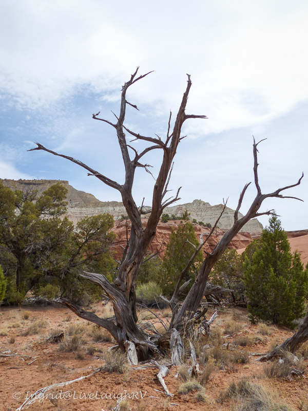


 The town of
 Oatman is a fun little place to visit. It’s an authentic old western town with wild burros roaming about and gunfights staged in the street. Although the burros are said to be tame and can be hand fed, they can also get aggressive if you have food in hand. We watched one women get surrounded by the burros and nipped when she wasn’t giving them food fast enough.


 During our many travels through this part of Minnesota, a stop or two to capture a photograph of the Split Rock Lighthouse was always on the agenda.


 My visit was a week before my birthday and as such a little souvenir shopping was in order. As much as I would’ve liked a nice chunk of petrified wood, the size and weight wouldn’t be conducive to life in an RV. I opted for a lovely bracelet that I found at the Rainbow Visitor Center Gift Shop.
 After a four hour drive, we pulled into the Elks Lodge parking lot in Santa Fe, New Mexico. We found a nice grassy spot to set up camp for three nights. It’s easy to fall in love with Santa Fe, New Mexico.


 I usually don’t like winging our travels during the most popular travel months of the year (July and August), but circumstances had us doing just that.
 Grand Teton National Park in Wyoming. Our
 wheel in tow, but Al and I were in serious winging it mode and threw caution to the wind.


 overnight at the Walmart in Craig, but there are signs all over posted ‘No overnight parking’. Al even confirmed with a store manager.
 at the main park office for the Rifle Gap Campground where I was able to ask all my questions.

 any cancellations.


 tour of mining locations found in the hills southwest of town.
 There are twelve points of interest along the green route that are clearly marked on the map and along the road way.
 The
The 
 Each numbered stop was clearly marked and offered information about the site. What surprised me most is that much of the land is still privately owned. Thus, the land we toured is owned either by private individuals, companies, the US Bureau of Land Management, or the US Forest Service. The tour is sponsored by the South Custer
  County Historical Society and White Knob Historical Preservation Committee.


 be renewed at any time to withdraw the millions of dollars of Ore remaining in the ground. Hmm, I wondered – does that mean I was driving over millions of dollars?

 motorhome. This artistic, talented gal and I hit it off, and I was quick to share the Mackay Mine Hill Tour with her.


