Take a Hike in New Mexico

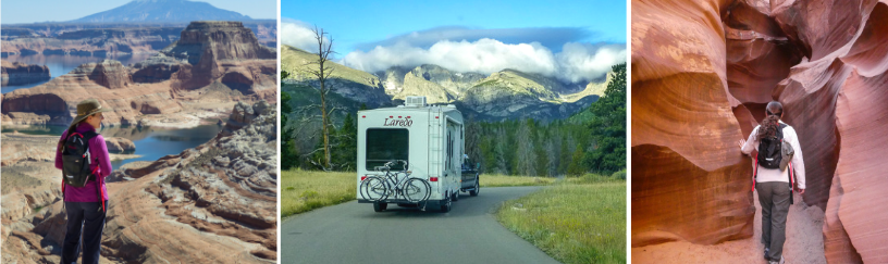
Some places resonate with me more than others. I’m not always sure why or what the deciding factor might be, but when I stumble upon a unique landscape that gives me goosebumps, I know I’m someplace special.

Kasha Katuwe

Between all the social media platforms, there’s no shortage of finding exciting travel inspiration. The moment I saw a photograph of these cone-shaped tent rock formations, I knew I had to see this place with my own eyes.

National Monuments

35 miles south of Santa Fe, New Mexico, is a complex and unique geological landscape called Kasha-Katuwe Tent Rocks National Monument. This relatively new monument was designated as such in 2001.

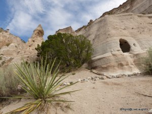
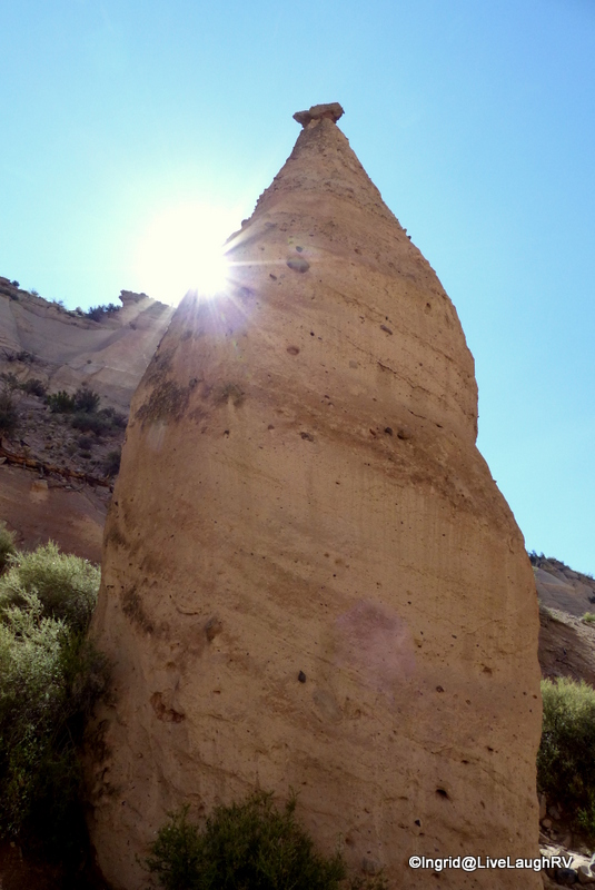
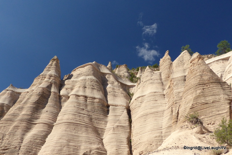
The sculpted cliffs and peaked hoodoos were formed from volcanic eruptions that occurred more than six million years ago.

There is a somewhat uniform layering of volcanic material causing bands of white, grey, beige, and pink colored rock.  It’s a fascinating and perplexing sight.

Over time, wind and water sculpt these rocks creating canyons, scooping holes, and contouring hoodoos. Mother Nature’s artistic and creative hand had me awed and smiling during the entire two-plus hour hike.  I found myself hiking this fun trail several times during our two-week stay in the Santa Fe area.

Kasha Katuwe Tent Rocks National Monument

Without further adieu, let’s take a hike…..

Getting there: As we approached the fee booth station, we were greeted by a ranger. There’s a $5.00 daily fee (as of Aug 2016) or free with your Annual National Park Pass.  From the fee station, we continued for five miles down a paved road that crosses private property owned by the Pueblo de Cochiti.

Kasha Katuwe Tent Rocks National Monument

We are asked to respect the traditions and privacy of the local Indians, and thus, no stopping along the way, no photography/video, and no drawing/painting.  Also, no commercial photography within the park is allowed without a permit.

Once we neared the trailhead, there were three different gravel parking lots that can accommodate just about any size vehicle (including RV’s).  There’s a couple of vault toilets, but no water….. so be sure and bring plenty of drinking water.  You’ll need it.

Awed beyond words!
Awed beyond words!

Unlike most national parks and monuments, there are no scenic overlooks near a parking lot around here. The only way to view the tent rocks and observe this stunning landscape is by foot; hiking via a dirt, sometimes sandy trail.  And by the way, no dogs are allowed anywhere. You won’t even be allowed through the fee station with a dog in your vehicle.

Kasha-Katuwe

The 1.2 mile Cave Loop Trail is rated easy and partly handicap accessible.  There are some unique rock formations and a hand dug cave along this trail, but the real gem of the park is the Slot Canyon Trail …… definitely not to be missed.

Kasha-Katuwe Cave Trail
Kasha-Katuwe Tent Rocks National Monument

The Slot Canyon Trail is a 3 mile (total) out and back hike with a 630-foot elevation gain and connects with the Cave Loop Trail.

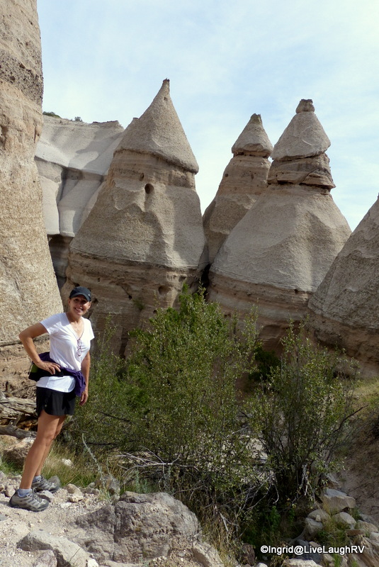
We hiked the combination of both trails making for a wonderful 4.2-mile hike. For my level of hiking ability, this trail offered me the perfect amount of challenge and visual stimulation.

Cave Loop Trail as we hike toward the Slot Canyon trail
the beginning of the Slot Canyon Trail

Although from Al’s point of view, there may have been way too much visual stimulation (if there is such a thing) which resulted in an excessive amount of photo-op stops, much to his chagrin.  Perhaps that’s why my subsequent hiking visits to Kasha-Katuwe were tackled as a solo hiker 😁

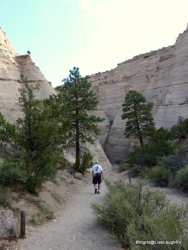
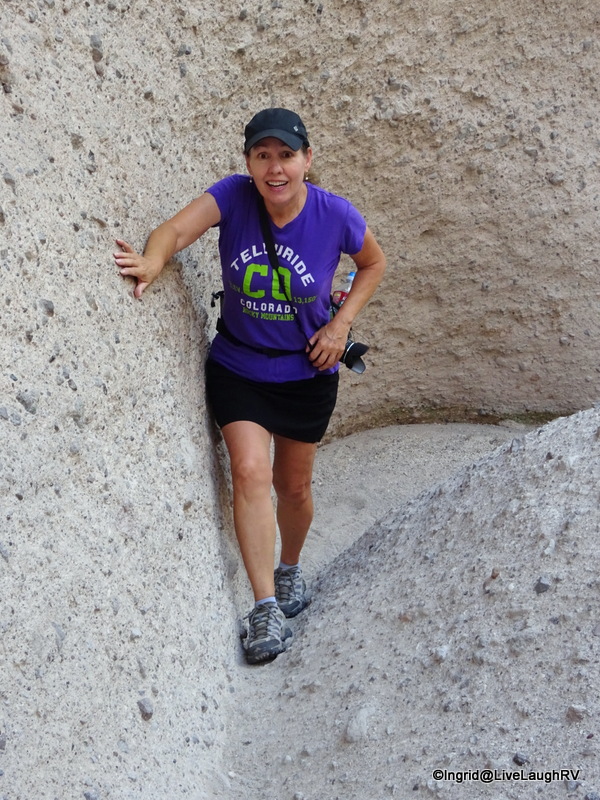
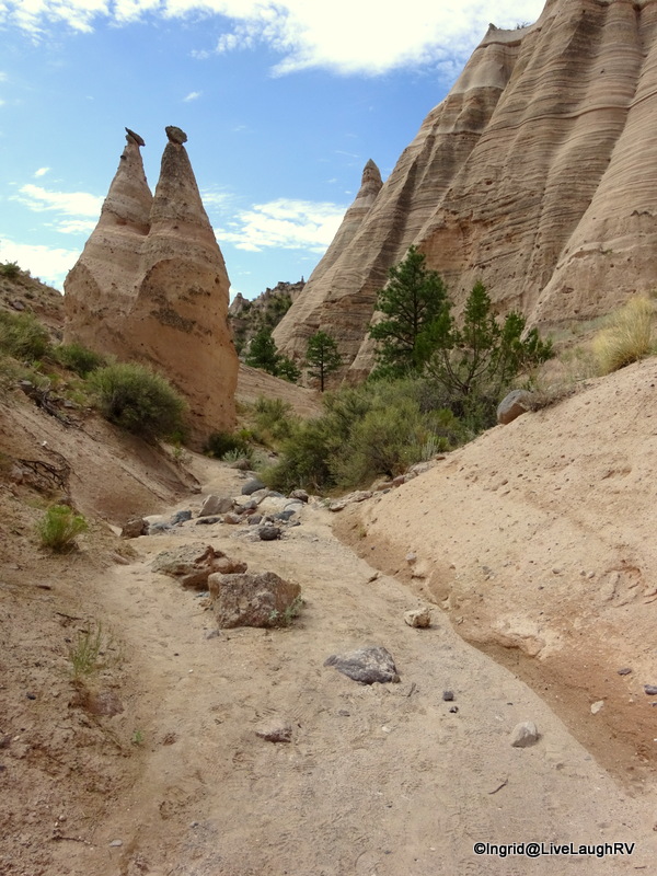
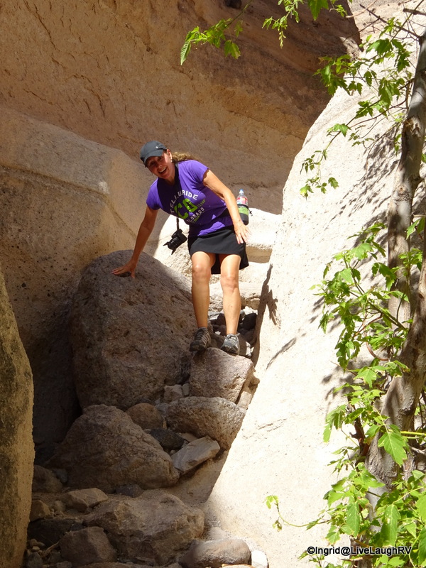
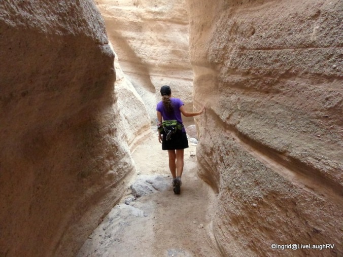
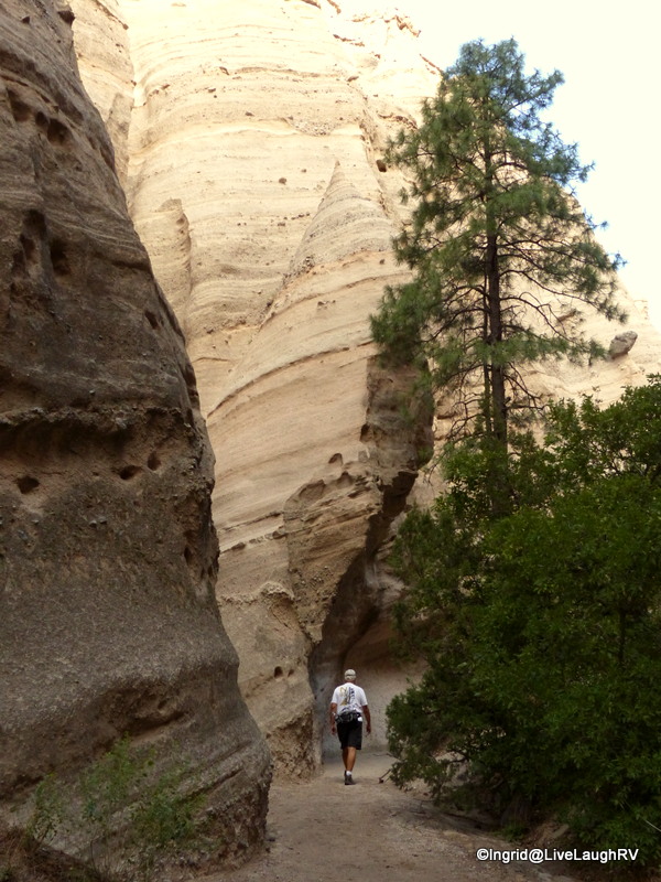
The moment we connected with the Slot Canyon Trail, the cliff walls rose on both sides and I felt like I had entered a secret garden of sorts. I believe, oh my gosh, was uttered by me around every bend.   As the canyon walls continued to narrow, we were greeted with obstacles along the trail.

Slot canyon hiking

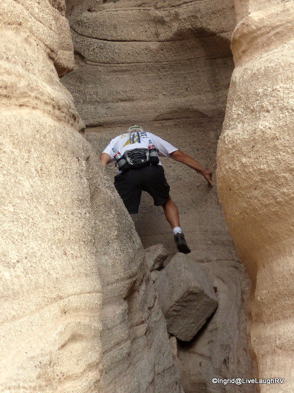
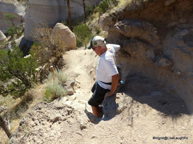
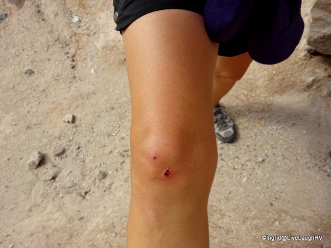
Nothing we couldn’t handle … however, those that are vertically challenged or suffer from short leg syndrome, like moi, may find themselves stretching out those leg muscles just a tad.

Easy peasy!
Easy peasy!

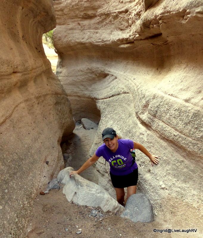
In some spots, the slot canyon became very narrow, so narrow that there was only room for one foot at a time.

one foot at a time!
one foot at a time!
one hiker at a time!
How cool is this?
How cool is this?
Fits like a glove!
Fits like a glove!
Loved it!
Awesome!

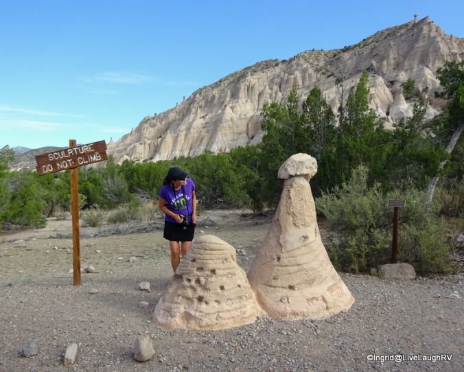
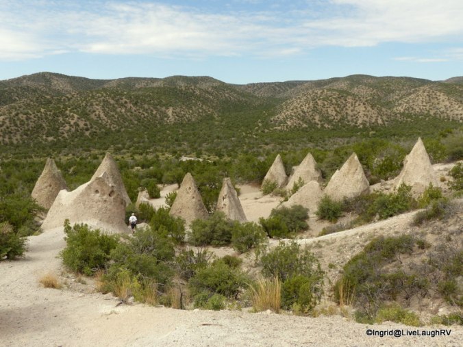
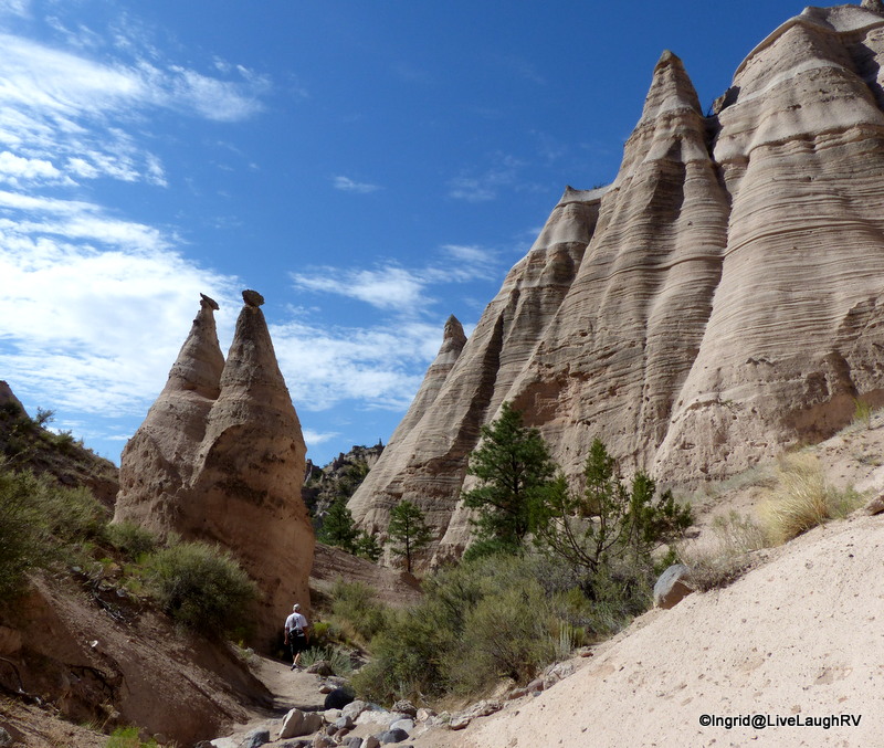
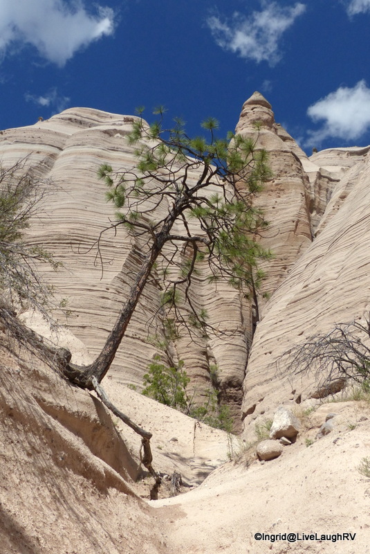
Once we exited the slot canyon, we were welcomed by those teepee shaped hoodoos …. each uniquely sculpted by the elements and each equally as impressive.

Kasha-Katuwe Tent Rocks National Monument
cairns
hiking

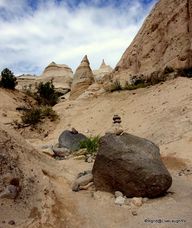
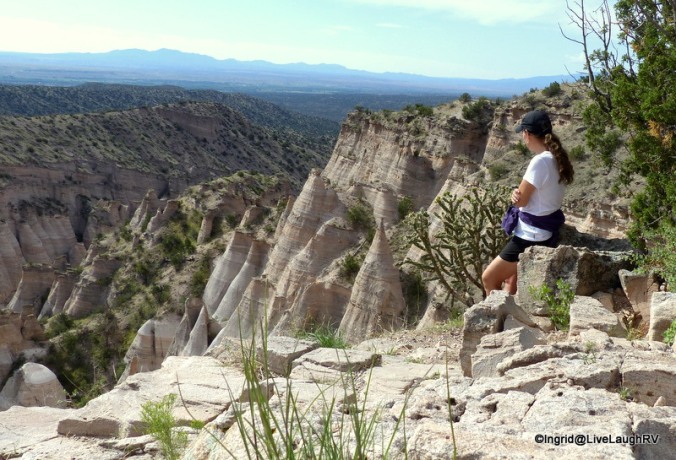
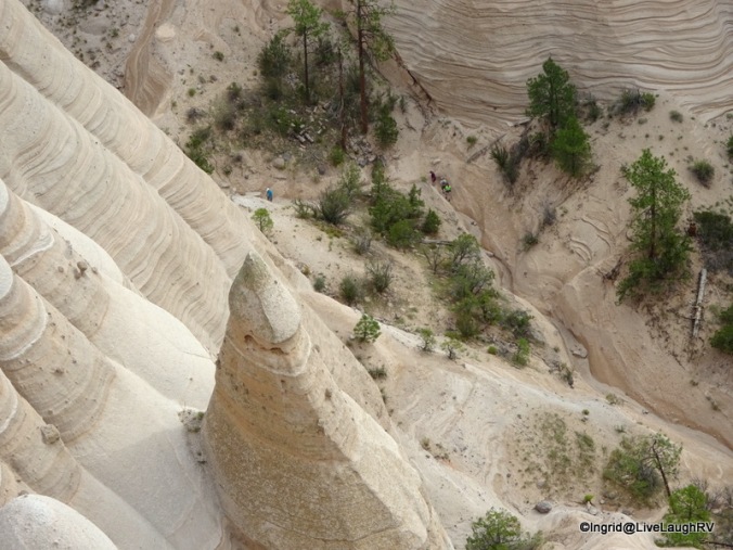
It didn’t take long and we could feel the trail climbing and instead of looking up at the amazing tent rocks, we were now looking down upon them.

Kasha-Katuwe Tent Rocks National Monument

We continued up the trail and stopped frequently to look back.

New Mexico hiking
this was the most challenging spot for me on the entire hike
Kasha-Katuwe Tent Rocks National Monument

As we reached the top of the trail, we had temporarily hiked away from the tent rocks. The trail continued out onto a narrow mesa which provided a bird’s eye view of Kasha-Katuwe Tent Rocks National Monument.

trail - drop offs on both sides. Birds eye view in all directions. The lake in the background is where we camped to be near Kasha-Katuwe; Cochiti Lake
The trail drops off on both sides. Bird’s eye view in all directions. The lake in the background is where we camped to be as near as possible to Kasha-Katuwe; Cochiti Lake Campground

And of course, a few more “Oh…. my…. gosh’es were uttered as I stood on the edge gazing down.

Standing on the edge gazing in awe!
Sitting on the edge as I admire the view below - hey look, there's the trail
Sitting on the edge as I admire the view below – hey look, there’s the trail
We can see hikers on the trail. Since this is a out and back hike, we'll be down there shortly!
We can see hikers on the trail. Since this is an out and back hike, we’ll be down there shortly!
Heading back down the trail.
Easy for someone 6'3".... entertaining watching the 5'4" short legged gal
Easy for someone 6’3″…. entertaining watching the 5’5″ short-legged gal
I steady myself
I steady myself
Not an obstacle I couldn't handle on my own!
Not an obstacle I couldn’t handle on my own!
This is where being short works in my favor ;-)
This is where being short works in my favor 😉

The return hike to the trailhead was every bit as amazing as it was at the beginning.

We returned back to the trailhead via the Cave Loop Trail

The Pueblo de Cochiti people view Kasha-Katuwe Tent Rocks as a very special place and justifiably so.  After Al and I made this first hike, I returned three more times to tackle this perfect (in my book) hike.  Perfect – even when considering all the obstacles one might bump into.

Oh no, someone wasn't paying attention!
Oh no, someone wasn’t paying attention! At least I managed to stop the blood from running down my leg.  I did attract a little attention from fellow hikers…. You know, those “Are you ok?” looks and comments.

One morning, I hit the trail at 8:15 and encountered only one couple on the trail for that first hour.  It was awesome having this amazing place to myself and hiking in solitude.  All of my senses were alert.

Kasha-Katuwe

The visual delight of the sun peeking from behind a rock was a reminder of a new day unfolding. I listened to the light sound of a lizard moving, and the loud squawking of birds soaring overhead.  I breathed in the crisp clean air scented of pine. There was the random sound of tiny rocks tumbling, acting as a reminder that this land is in a constant state of change.

Kasha-Katuwe

There was the occasional touch of admiration and respect for this special and sacred place.

sitting on the edge!
My church!
My church!
Kasha-Katuwe

Yes indeed, some places touch my soul more than others and Kasha-Katuwe touched mine more than I ever expected.  I sure hope to return someday!


Eerie yet Beautiful

Upon entering the park for the first time, I was met with a diverse flood of thoughts ranging from eerie to beautiful.  The land appears stark and foreboding, but if you look close, a vast array of life can be seen.Craters of the Moon

I was lucky to visit Craters of the Moon National Monument and Preserve at the very beginning of wildflower season, and since arriving in Arco, Idaho, in early May, I’ve been dropping by the park regularly to keep an eye on the status of the craters of the moon
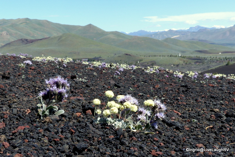
wildflowers.   With each visit, more and more delicate beauties were popping up.

In early June, I was able to share this strange and scenic place with friends, Faye and Dave.

I believe the peak of wildflower season is suppose to be in mid June, but we thought our timing was darn good and were overjoyed with the abundance of blooms everywhere we looked during our early June visit.

Dave and I were going crazy with our cameras trying to capture the gorgeous periwinkle color of the Scorpionweed.

those wildflowers captivated our attention
Scorpionweed flowers captivated our attention

Since I’d had a few weeks to explore Craters of the Moon before Faye and Dave’s visit, I knew exactly where to find an abundance of wildflowers to photograph up close, but that would require a bit of a climb… a climb up the inferno cone.

it was hard to photograph 'inferno cone' and capture its size. Note the hikers on the trail - offers scale.
it was hard to photograph ‘inferno cone’ and capture its size. Note the hikers on the trail – offers scale.

me climbing the Inferno Cone at Craters of the Moon

With less than a half mile up and back, this large, black, barren hill is worth the 160 foot elevation gain.  Once at the top, there are views in all directions and a surprise bonus of wildflowers.  We were also able to observe the spatter cones from above.

At the top of inferno cone - views of spatter cones
At the top of inferno cone – views of spatter cones

What exactly are these cones?  A cinder cone, like the inferno cone, are formed when gas-rich volcanic froth erupts high into the air then falls back to earth forming a huge mounded pile of cinders.  Spatter cones are miniature volcanoes that form when thick, pasty globs of lava plop up to the surface, piling up in the shape of a cone.

Craters of the Moon
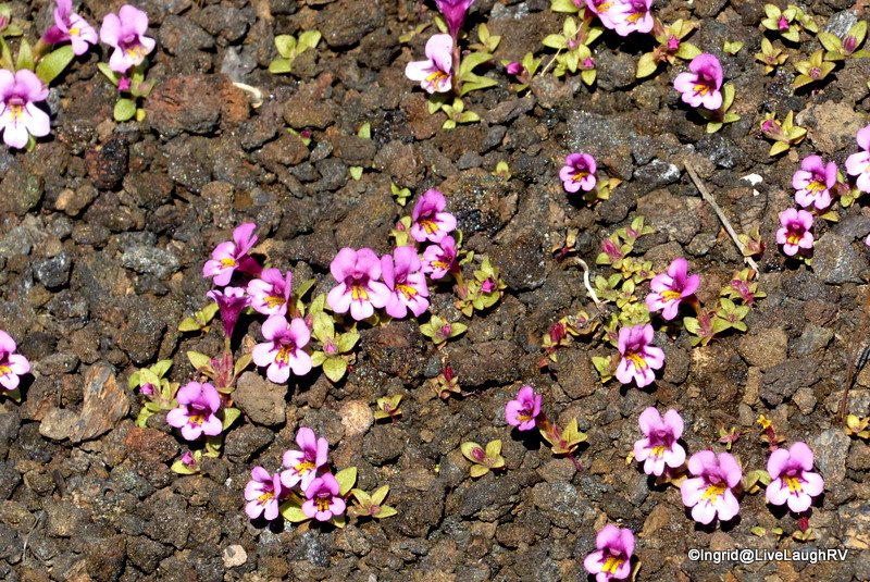
The volcanic nature of the park, creates a lunar like terrain.  So much so, that NASA routinely uses Craters of the Moon NM for research and development.  In 1969, Apollo Astronauts prepared for their moon mission here at Craters of the Moon.

Next week, the Mountain View RV Park (our work camping home this summer) will be hosting a large group of NASA scientists/engineers, which will keep all of us super busy for a two week period.  All hands on deck!

After Faye, Dave, and myself hiked the inferno cone, it was time to explore another interesting geological feature – a lava tube.  Lava or magma?  Hot, molten rock from deep within the earth is called magma. When magma erupts onto the earth’s surface, it’s called lava.  A lava flow that hardened on the outside while the lava still flowed within, creates a lava tube.

me inside Indian tunnel lava tube

There are several lava tubes in Craters of the Moon that are accessible for exploring, but most are geared toward those familiar with caving.  Since we didn’t fall into that category, we opted to hike the Indian tunnel cave/tube which is clearly marked and offers enough daylight to explore without a flashlight.  There is one short section though where I thought the aid of a little artificial light was helpful.

There is a fair amount of rock scrambling involved in this hike, especially at the end of the tunnel where we exited out of a small hole.

The exit
The exit

Me exiting Indian tunnel lava tube

Before embarking on any lava tube exploring, a permit is required.  The permit is free and is simply a matter of answering a few questions at the visitor center regarding any previous caving.  This is for the health of the bat population and to stop the spread of white nose syndrome.

Yes, we were hiking down in there!

I have to admit, the first time I hiked the lava tube, I was extremely uncomfortable.  This time around, I knew exactly what to expect and was familiar with the general area of the trail.  Thus, the second time around was much more enjoyable.  Oh, and entertaining company always helps 😉

me, Dave, Faye inside Indian tunnel lava cave tube
Me, Dave, Faye inside Indian tunnel.  Dave enjoyed introducing us as “his wives” to fellow hikers.

Although the caving was a fun experience, those wildflowers were calling.  And several more stops were in order.  Over 600 different types of plants have been identified growing in Craters of the Moon.

Dave stalking wildflowers!

We stayed on the road to photograph the stunning display of wildflowers.  These delicate plants have to overcome a lack of moisture, meager soil conditions, and surface temperatures that can exceed 150 degrees Fahrenheit.  The thought of accidently stepping on one of these beauties, was not an option.  Respect and admiration for these tough little things were at the forefront of our minds as we took in the amazing sight.

Cryptantha
Cryptantha

Scorpionweed and Dwarf Buckwheat

Equally as striking were the carpets of pink produced by the Dwarf Monkeyflower.  If there was any open space, the Monkeyflower was eager to fill it.

a pink carpet of Dwarf Monkeyflower

Monkeyflower

Dwarf Monkeyflower up close

Thank goodness for digital photography or I fear Dave and I would’ve easily run out of film.  Eventually, we returned back to camp where Al was eagerly awaiting our return.  While we were having fun, he was busy building picnic tables and seems we all had worked up an appetite.

Al, Dave, Faye, and me at our place at in Arco, Idaho
Al, Dave, Faye, and me at our place in Arco, Idaho

We enjoyed a healthy meal of grilled chicken, baked potatos, steamed broccoli, followed by my somewhat healthy carrot cake cupcakes.  For my carrot cake cupcake recipe, click here.

I’m sure as the summer progresses, I’ll continue to visit Craters of the Moon, but up next, Al and I take a vacation!

Craters of the Moon
Syringa growing in a crevice

Live life to the fullest.  Don’t let the weeds smother out your flowers – unknownWildflowers

Here’s my latest addition to my arsenal of photography toys…. after having a camera topple from a fence post, I felt it was time to invest in a light, easy to carry, tripod.JOBY GorillaPod Hybrid Tripod for Mirrorless and 360 Cameras – A Flexible, Portable and Lightweight Tripod With a Ball Head and Bubble LevelJoby gorilla pod

A Pleasant Surprise

“That one looks good”, I say to hubby as I point to the campsite.  “Are you sure you don’t want me to drive around the loop?”, he questions.  “Nope, looks perfect and level”.  Within fifteen minutes we’re all set up in site #25 at Rockhound State Park near Deming, New Mexico.

Rockhound State Park
Rockhound State Park, Deming, New Mexico

RVing in New MexicoWhat a pleasant surprise this little state park turned out to be.  All the sites are large, well spaced, and most are pretty level.  I’ll admit I was tempted to return to City of Rocks State Park as I was so enamored by that place last winter, but that campground is located 30 miles north of the interstate and Rockhound is only 12 miles off the interstate.

Rockhound state park
site #25 Rockhound State Park, Deming, New Mexico

Since we’re only staying one night we even tossed around staying at the Escapees Club Park – Dream Catcher RV Park.  That RV Park is right in the town of Deming making it easy on and off the interstate.  But you know me, it’s all about the views…. gotta have those views!  I’ll gladly give up hook-ups for views, but here I’ve got views AND electric…. score.

RVing in New Mexico
Thunder Egg Trail

hiking at Rockhound State ParkWhile my chauffeur checks out his MacGyver’s handy work to make sure the repairs held together after a 4 1/2 hour drive, I check out the hiking.  How convenient for us to be parked right across the street from the Thunder Egg Trail trailhead.  This is an easy 1.1 mile trail that leads from the campground to the day use picnic area.  It meanders along the Small Florida Mountain Range.RVing in New Mexico

RVing in New MexicoThere’s prickly pear in every direction along with various yucca plants. But the main attraction here are the rocks.  Folks come here in search of precious gem rocks.  The gathering and collecting of rocks is ok and expected.

Yep, feel free to help yourself to a few rocks.  Personally, I didn’t take even one rock as visions of Lucille Ball in the Long, Long Trailer came to mind.

All in all, we loved our one night stay at Rockhound State Park and hope to return for a longer stay next year.RV in New Mexico

Moving on down the road, we continue our journey toward the town of Alamogordo, New Mexico……

The Practical Geologist: The Introductory Guide to the Basics of Geology and to Collecting and Identifying Rocks
Smithsonian Handbooks: Rocks & Minerals (Smithsonian Handbooks)
TCM Greatest Classic Films Collection: Comedy (Arsenic and Old Lace / A Night at the Opera / The Long Long Trailer / Father of the Bride 1950)